High chance new storm will form in the Atlantic; here's what the models show
Published in News & Features
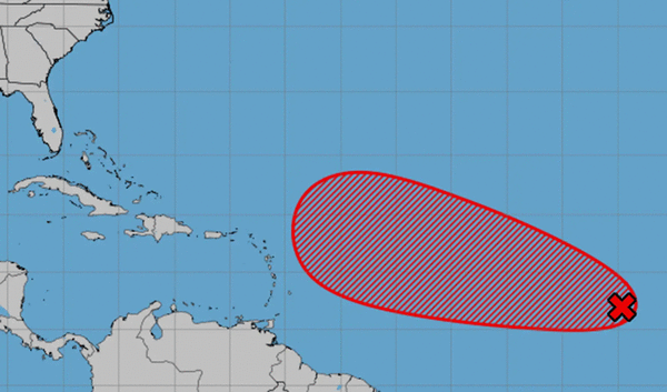
MIAMI – Overnight, the disturbance in the eastern Atlantic developed little, but forecasters still give it a high chance of forming a tropical depression or storm this week.
As of 8 a.m. Wednesday, the National Hurricane Center held steady with its prediction of a 30% chance of formation in the next two days and a 70% chance of formation in the next seven days.
The hurricane center said conditions in the Atlantic “remain conducive for gradual development” over the next few days, and the system could develop by the end of the week or weekend and move west.
Where it goes from there — if it develops at all — is still an open question.
The system is very far away. Most long-range weather models show it moving west toward at least the easternmost Caribbean by next Wednesday. But with no firmly developed center yet, the models are not that skilled at predicting the system’s next moves.
So far, many different varieties of global model have predicted the system will strengthen a bit and move west throughout the next week, but from there, some take it on another northern curve (like Hurricane Erin and Tropical Storm Fernand) and others keep it low and take it farther into the Caribbean.
“Still unclear if it impacts the islands or what it becomes before that longitude. What is also unclear is if it follows an Erin or Fernand type path. This will depend heavily on the strength of the system and where it lies,” Jim Cantore of the Weather Channel posted on X Wednesday morning. “ Lots of uncertainty remains with this next wave, but it will be the thing to watch through mid month.”
The next name on the list is Gabrielle.
©2025 Miami Herald. Visit at miamiherald.com. Distributed by Tribune Content Agency, LLC.


Comments